
Guest Blogger – Janire @rayofsun_adventures
During the pandemic, I have felt so lucky to have the magnificent Shropshire Hills on my doorstep to explore. I have also found joy in learning about the history, myths, and legends associated with them. Here are my top 5 Shropshire Hills for hiking, I hope it inspires you to get into the hills and exploring!
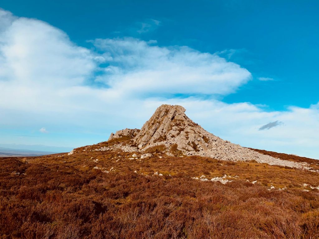
- The Stiperstones
Stiperstones is a National Nature Reserve and known for the beautiful purple heather and wildlife including red grouse. It is characterised by rugged, jagged mounds of Quartzite rock, formed 480 million years ago during the Ice Age. The summit stands at 536m.
Legend has it that The Devils Chair, the second-highest peak of Stiperstones was created by the Devil who was carrying rocks to fill in the valley known as Hell’s Gutter. The Devil is said to have stopped for a rest at the top. When he got up, he tripped, his apron strings ripped, and he dropped the rocks. It is said that witches and evil spirits continue to meet with the Devil when the rocks are covered by clouds.
The area was once owned by Wild Edric, a Saxon noble in the 11th Century. When the Normans invaded England he fought hard to defend his land, but lost and had to make peace with William the Conqueror. Legend states that for his failure to defend his land he was imprisoned in the lead mines by the witches and remains there to this day. If you see the ghost of Wild Edric galloping on his horse across the hills, it means war is imminent.
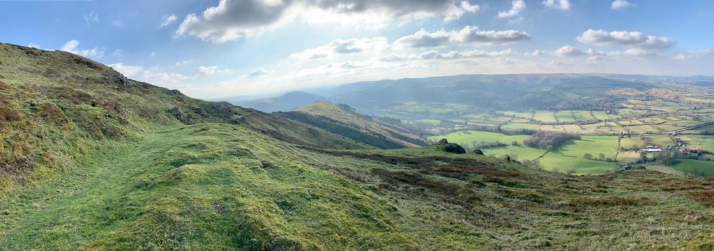
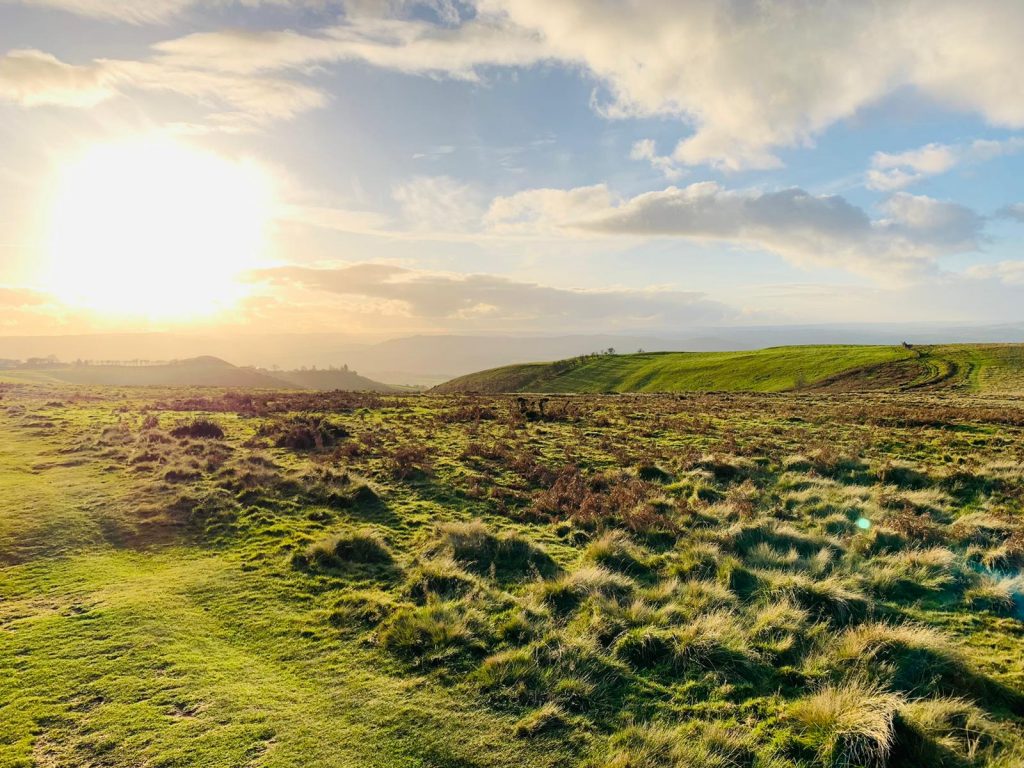
2. The Long Mynd
The Long Mynd in Church Stretton is a firm favourite thanks to the beautiful wild Welsh Mountain Ponies that roam freely with their foals.
Atop the Long Mynd is a mixture of old and new; from the Portway, a Neolithic trading route to the modern-day gliding club. The Milky Way can be seen from the highest peak of the Long Mynd, Pole Bank.
Shooting Box is a rare bell barrow that dates to 1950-1700BC and is one of sixteen Bronze Age burial mounds on the Mynd. It is named after a grouse shooting hut that stood on the land until 1992.
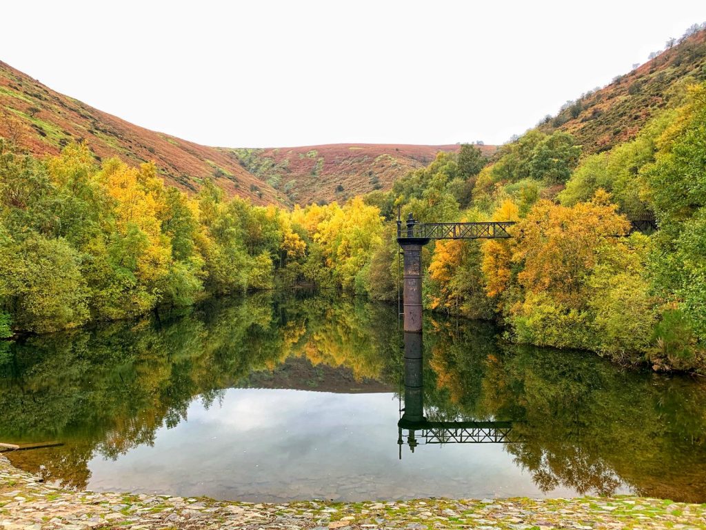
Lower down you can find Carding Mill Valley, the popular wild swimming spot Pool Hollow reservoir, and the Light Spout Waterfall.
3. Titterstone Clee Hill
Titterstone Clee is the third-highest Shropshire hill. It is formed of Dhustone, a carboniferous dark dolerite rock that was used in the construction of the docks of Cardiff.
The hill itself has both working and disused quarries. Many of the disused quarry buildings have been covered in beautiful graffiti.
It is also host to several radar domes and towers which look like giant golf balls and give the area a surreal and ethereal feel. The largest of the domes is part of the National Air Traffic Services radar network and the smaller of the two domes is a Met Office radar station.
Titterstone Clee has a long history of human activity dating back to the Bronze Age with evidence of cairns and a 4000-year-old hillfort near the trig point.
The rocky outcrop, The Giant’s Chair, is where the Giant of Clee Hill would sit, calling over and making fun of the giants of Brown Clee and Abdon Burf leading to a great war between them, remnants of which can be seen all over the local hills.

4. Stapeley Hill
Stapeley Hill is home to Mitchell’s Fold, a Bronze age stone circle, and several cairns. Built over 3000 years ago, there used to be 30 stones but only 14 remain standing in a circle with one in the middle.
Legend has it that during a time of famine, a passing fairy gave the local people a magic cow that provided an endless supply of milk. One night, an evil witch milked her into a sieve. When the cow realised the trick, she disappeared. The witch was turned to stone and a circle of stones was erected around her, to ensure that she could not escape. Cows are drawn to the stones and use the largest one as a scratching post, probably taunting the witch.
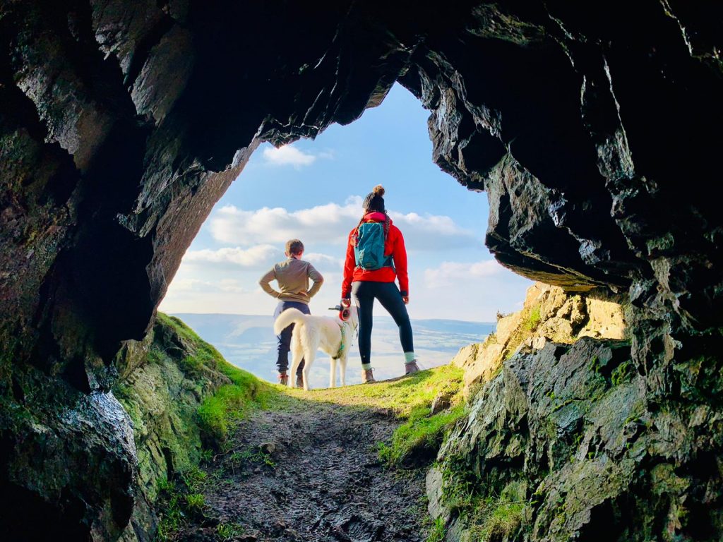
5. Caer Caradoc, Church Stretton
Carer Caradoc has a ‘whaleback ridge’ which looks like the backbone of a giant creature buried under the earth. It is volcanic in origin and its name means ‘The Fort of Caradog’ in Welsh.
Near the summit, there is an ancient Iron Age hillfort and cave. Legend has it that this was where Caractacus was defeated by Roman legions during their conquest of Britain and that he hid in the cave when the fort was captured.
The cave is also allegedly the hiding place of King Arthur’s Cauldron of Di-Wrnach, which contains the treasures of Britain and a magical sword.
Written by Janire, a travel blogger based in Shropshire who specialises in camping, outdoors and adventure travel. Her blog posts have been featured by Acacia Africa, Nearly Wild Camping and Tentbox. Check out her Instagram account for some fantastic travel inspiration @rayofsun_adventures